ECONOMIC STRUCTURE
89.7 percent of jobs generated came from agriculture, 6.3 percent from fisheries, and 1.3 percent from forestry/wood. Taken together, they produced 97.3 percent of the jobs. Of the total jobs created in agriculture, 65.94 percent came from coconut, 14.47 percent from corn, 9.4 percent from abaca, 4.11 percent from banana, 3.85 percent from rice, and less than 1 percent each from root crops, mango, vegetables/legumes, and durian. Of the production value, 47 percent came from coconut, 17 percent from fisheries, 12 percent from banana, 10 percent from corn, and 11 percent from rice.
Leading Industries :
Agriculture
Fisheries
Forestry/Wood
89.9% of jobs generated came from Agriculture
1. CROPS
Davao Oriental is the largest coconut-producing province in the region and contributes an average of 7.4% to the country’s total production or equivalent to 1.06 billion nuts. All municipalities have land planted to coconut. The top 4 municipalities in terms of number of hectares planted to coconut are Baganga, Mati, Caraga and Gov. Generoso. Together, they produce 60% of the coconuts produced in the province. Davao Oriental produced only 14% of the total rice produced in the region. Rice is produced in 8 of the 11 municipalities. Of those 8, Banaybanay, Cateel and Lupon are the top 3 producers.
Together they produce 78.5 percent of the total rice production in the province. Davao Oriental’s corn production from 2001 to 2006 was 23% of the region’s. It was less than Compostela Valley’s 27% and Davao del Sur’s 31%. Corn is planted in all municipalities. Manay, Mati and Caraga are the top three producers. Davao Oriental produced the least quantity of mango at only 4% of the region’s total production. Mango is planted in 9 of 11 municipalities and 82 percent of mangos planted are in Mati and San Isidro. Davao Oriental is the top producer of abaca fiber in the region and the fourth in the Philippines. 93% of abaca produced came from District 1. Manay produced the most at 37% of the total production of the province. The province has the least production of banana in the region. This is an indication of the largely untapped potential for banana production especially for intercropping with coconut trees. Banana is produced in all municipalities.
The top 5 producers are the 5 municipalities in District 2. Together they produce 83.5% of the total production of the province. Davao Oriental ranks 4th in cassava production, that produces 14.1% of the total production of cassava in the region. Cassava and other root crops are planted in all municipalities. The top three producers are Mati, San Isidro, and Gov. Generoso.
Baganga has the most number of hectares planted to rubber.
From 2002 to 2006, no production of rubber was reported because the trees that were planted were still young and not yet ready for tapping.
These are the following crops produced :
Coconut
Rice
Corn
Mango
Abaca
Banana
Cassava
Rubber
2. LIVESTOCK AND POULTRY
The Province is sufficient in cattle, carabao and swine, but insufficient in chicken meat and eggs.
Major Livestock Commodity :
Goats
Cattle
Swine
Poultry (native and layer)
Sheep
3. AQUACULTURE AND FISHERIES
The provinces fish production in 2006 was 17,247 MT, lower than the previous year due to the decrease of production in the commercial and municipal fishery sector. 73.46% of the province’s aquaculture production came from brackishwater sources and 24.46%.
Major fishing grounds :
Davao Gulf
Pujada Bay
Mayo Bay
Manay Bay
Baculin Bay
Caraga Bay
Cateel Bay
4. FORESTRY/WOOD
Largest production forest in the region
Total production forest of the Province is 125,155.2 hectares
Baganga and Caraga ( both in District I) account for 62,526.4 hectares or almost 50% of the total production forest
5. MINING
Total area for production of minerals is 21.5% of the region
Minerals produced :
Chromite
Copper
Silica
Magnesite
Manganese
Molybdenum
6. TOURISM
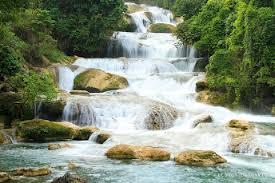
There are a total of 122 potential tourist spots/destinations in the province. Tourist spots or destinations consist of islands, waterfalls, white sand beaches, rivers for trekking, bays and coves for kayaking and scuba diving, lakes, caves, hot springs, mangrove resorts, historical and religious sites, cultural sites, and nature preservation areas
7. TRANSPORTATION, ACCESS & CIRCULATION
A total of six (6) ports in the province, five (5) in the Second District and one (1) in the First District. Secondary airport in Mati that could be a key entry and exit point in Southern Philippines has been underutilized. Airstrip/airport in Lambajon, Baganga which was used before for commercial flights when the road conditions in the First District were still very bad. It has also been underutilized. The province has a total of 2,334.6 kilometers of road 393.8 kilometers of which are national roads, 491.2 kilometers are provincial roads, 101.9 kilometers are municipal roads and 1,347.2 kilometers are barangay roads.
1. Airports
2 airports/airstrip
2. Seaports
There are a total of six (6) ports in the province
3. Road Network
The Province has a total road density of 1.18 km/sq.km of A & D lands


